Quantcast
Channel: Bus – Caught (up) in traffic
Viewing all 86 articles
Browse latest View live

Antipolo’s bus port

$
0
0

I like taking photos of aircraft of various airlines in airports. Among the photos I like taking are of their tails aligned to show the different airlines docked at the terminals. As we were stopped at an intersection just across from the Robinsons Antipolo public transport terminal, the wife took this photo of buses at the terminal. To me, the terminal has become somewhat like a bus port; with buses serving the long distance routes between Cubao in Quezon City and Antipolo in Rizal province. That’s about 20+ kilometers via Marcos and Sumulong Highways.

What used to be a small amusement part has been cleared prior to the lockdown in March and the area now functions as a parking lot for buses serving the Antipolo-Cubao via Masinag Junction and Antipolo-Ortigas Center routes. The latter was already operational prior to the lockdown with P2P buses leaving every 30 minutes.

When the Antipolo-Cubao bus route first started operation when Rizal and Metro Manila first transitioned to GCQ, there were three (3) companies operating along the route – G-Liner, RRCG and EMBC. All used air-conditioned buses. Before MECQ in early August, there were additional companies including those that deployed regular or non-aircon buses. I will try to take more photos of the terminal, the buses and the paratransit providing local transport (i.e., within Antipolo). These are tricycles of different models including the conventional motorcycles with sidecar, the tuktuks, and the e-trikes.


Other buses operating the Antipolo-Cubao route

$
0
0

I had mentioned in previous posts that more buses have been deployed to serve the Antipolo-Cubao route. The route had already evolved to have two alternatives: the original route via Aurora Boulevard, Marcos Highway and Sumulong Highway, and the variant that goes through Cogeo and passes through Olalia Road to/from Sumulong Highway. Here are a couple of photos showing a couple more bus companies that used to ply other routes via EDSA.

Jayross Lucky Seven Tours bus – these used to ply the Fairview-Baclaran route via Commonwealth Avenue and EDSA with all aircon buses.

Diamond Star bus – these used to ply the Malanday-NAIA route via EDSA with both ordinary and aircon buses

More photos of other buses now serving the Antipolo-Cubao route.

Requiem for the Antipolo-Cubao jeepneys?

$
0
0

From the time Metro Manila and Rizal transitioned to General Community Quarantine (GCQ), there have been limited public transport services connecting the two considering most Rizal towns are like bed towns to Metro Manila. The term “bed town” refers to towns, or municipalities, even cities, that are basically the place of residence of persons who during the day time usually travel out to workplaces or schools outside their areas of residence. Many who reside in Rizal province actually work or study in Metro Manila. Similar cases may also be found in the other provinces surrounding Metro Manila like Bulacan, Laguna and Cavite. These connections are made mainly by public transport, which for the National Capital Region (NCR) and adjoining areas currently comprise about 70% of total trips. The rest is by private transport. [Note: Not counted are trips mainly by walking and cycling. While everyone walks, walking is usually at the ends of the commutes.]

Current public transport services now comprise of buses plying the Antipolo-Cubao and Taytay-Gilmore routes that were among the first operationalized under the rationalization program of the Department of Transportation (DOTr). For the Antipolo-Cubao route, several companies have shared the load with mostly aircon buses running between Quezon City and Antipolo City. I wrote recently that there are now non-aircon (referred to as ordinary) buses serving this route and that in addition to the main line (Aurora Blvd.-Marcos Highway-Masinag Junction-Sumulong Highway via) there was now a branch going through Cogeo and via Olalia Road.

Aircon bus approaching the Robinsons Antipolo terminal

Non-aircon (ordinary) bus plying the Antipolo-Cubao route along Sumulong Highway past the Masinag Junction

We got a comment about how perhaps DOTr and LTFRB plans to introduce variations to main routes including adding to the route number to distinguish one variation from another. While the original route signs look like the one on top of the windshield in the Aircon bus in the first photo with the white box on the left displaying the route number, the bus in the second photo shows two boxes. The second box to the right of the route name is blank. So perhaps there can be an ‘A’ to refer to the original Route 9 and ‘B’ can refer to the one via Cogeo. Does this mean there can also be a ‘C’ and that can be via the even older route via Felix Avenue, Cainta Junction and Ortigas Avenue. If this becomes a reality, then that probably puts the proverbial last nail on the coffin of the Antipolo-Cubao jeepneys. Jeepneys would have been phased out for the route in favor of the higher capacity buses.

On bicycles and transit

$
0
0

Here is another quick share of an article on bicycles and transit (i.e., public transport):

Cox, W. (2020) “Bicycles: A Refuge for Transit Commuters?”, New Geography, https://www.newgeography.com/content/006753-bicycles-a-refuge-transit-commuters [Last accessed: 9/4/2020]

What do you think? Are we getting there in terms of the bicycle-transit relationship? MRT and LRT lines have allowed foldable bikes to be carried in their trains but buses and other road-based public transport may not allow you to bring your bike inside the vehicle. For the latter vehicles, there are usually racks installed in front of the vehicles that can accommodate 2-3 bikes. Train stations now should have bicycle parking facilities for the last mile trips of their passengers.

Public transport along Route 8: Cubao-Montalban

$
0
0

I had to go back to my usual commuting route to my workplace via Tumana as Marcos Highway is usually congested in the mornings. As such, I had the opportunity to take some photos of public transport modes along the way.

Bus plying Route 8 – Cubao Montalban along the Marikina – San Mateo – Montalban Road (J.P. Rizal Avenue in Marikina City). Montalban is the old name of the Municipality of Rodriguez in Rizal Province.

A Beep, a modern jitney that is actually a minibus plying to Parang-Stop & Shop route that used to be dominated by conventional jeepneys. That is, of course, a conventional tricycle on the other side of the road. By conventional I mean a motorcycle with a side car, which is the most common type of 3-wheeler in the country.

Recently, I saw G-Liner buses along Route 8. That means the bus company’s fleet is now distributed along 3 routes serving Rizal province and connecting it to Metro Manila. While, capacities are still limited due to physical distancing requirements, these buses should be able to carry a lot more passengers once the situation ‘normalizes’ so PUVs are able to maximize their seating (and standing) capacities.

On the continued lack of public utility vehicle services – some observations

$
0
0

Traveling along Marikina roads en route to my office, I spotted not a few of the minibuses that are being promoted as modernized or modern jeepneys. These are definitely not jeepneys or jitneys but small (or mini) buses. They are airconditioned with seating capacities about the same as the typical conventional jeepneys but with space for standing passengers once these are allowed given the pandemic. There’s a lot near the end of the Gil Fernando Avenue Extension that serves as a depot or parking lot for vehicles that have not been deployed (or sold?). And here are a couple of photos showing these.

New mini-buses being touted as “modern or modernized jeepneys” parked along the Gil Fernando Avenue Extension connector road.

These mini-buses used to ply the SM Masinag – SM Fairview (via Marikina and Batasan) and Cogeo – SM Aura (via Marcos Highway and C-5) routes.

There is a perceived continued lack of public transport supply in Metropolitan Manila and its adjacent cities and municipalities. This is evidenced from the long lines at terminals and stations and the many people waiting for a ride along streets. With the DOTr and LTFRB slowly but surely adding buses, “modern jeepneys” and conventional jeepneys along many old routes and new ones, it may seem that there are enough vehicles. The situation may be summarized as follows:

  • The DOTr and LTFRB are taking advantage of the situation to try to rationalize public transport routes under their rationalization program. Certain routes, for example, that were served by conventional jeepneys are now assigned to buses and ‘modern jeepneys’. You can’t exactly blame them for this as the lockdown presented the opportunity to sort of start from scratch in as far as rationalization is concerned. They won’t get another chance at this without stiff resistance from various stakeholder groups.
  • PUVs are still limited in terms of allowed/permitted passenger loads due to physical distancing requirements. These are already being eased for both buses and jeepneys but standees are not yet allowed for buses.
  • The observed lack of supply is not as widespread as perceived. Commuters along some routes are better off than others. Traffic congestion due to the preference and use of private vehicles by many who used to travel by public transport exacerbates the situation as PUVs are unable to make quick turnarounds thereby making it appear that there is not enough of them operating. Approving and deploying more public transport without exerting efforts to improve confidence in using them will only lead to more congestion and inefficiencies to their operations.

On maximizing seating capacities of public transport

$
0
0

The restrictions for physical distancing for public transport seems to be easing. The reason for this statement is the observation that passengers of public utility vehicles are no longer one seat apart (less than the ideal 2m distance between people but deemed sufficient with physical barriers installed in the vehicles). If allowed to be seated next to each other (of course with some sort of physical barrier between them), the set-up will increase the allowed passenger capacities of PUVs to at least their seating capacities. Conventional jeepneys will be able to seat the 16 to 20 passengers their benches are designed for and buses, depending on their sizes and seating configurations may seat perhaps 40 to 60 passengers. That doubles or even triples the number of passengers that can be carried by each vehicle from the time these were allowed to resume operations after the lockdowns.

Plastic barriers separate passengers seated beside each other

Not all physical barriers are designed and installed to provide whatever protection passengers can get from them. The photos above for a G-Liner bus seems to be the more desirable design as the barriers are practically like curtains. I have seen token plastic barriers installed in jeepneys. I wonder if these even went through some approval process of the DOTr, LTFRB or local government unit. Such inferior designs do not help the cause of promoting public transport use over private vehicles.

Some observations and thoughts about the EDSA carousel

$
0
0

Much has been written or said about the EDSA Carousel. This is the express bus service the government implemented along Metro Manila’s busiest thoroughfare, EDSA or Circumferential Road 4. I feel that it is a decent effort from government to address the lack of supply to address the huge demand for public transport along EDSA considering that it serves to also distribute trips collected from major roads connecting to it. Is it an admission of something wrong in terms of the transport infrastructure along EDSA? Perhaps and from the current administration and DOTr. The admission of flaws certainly did not or will not come from the previous administrations that failed to address problems pertaining to Line 3 including maintenance and operations issues.

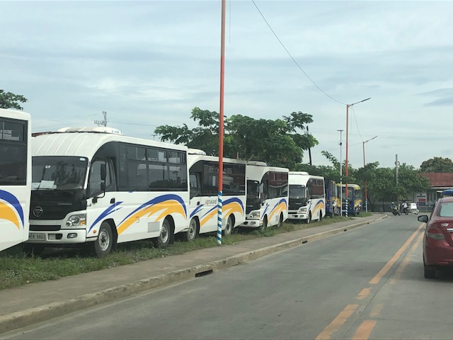
Buses queued before the Trinoma/North Avenue Station of the carousel. Overhead is the junction to the EDSA-MRT depot underneath Trinoma.

The overhead junction is the MRT’s branch to/from the depot

Buses queuing towards the North Avenue Station

The carousel stations are basically part of the MRT station with the platform located at ground level at the otherwise underutilized space that is the median island of EDSA. Access to the express buses are via the MRT stations as there are no other means for crossing to/from the carousel berths.

The carousel is an attempt to have a Bus Rapid Transit (BRT) along EDSA. It is perhaps the most practical solution to supplementing the already limited capacity of elevated Line 3 despite the continued operations of regular buses. The express bus service is not a new idea along EDSA since Line 3 had to compete with a BRT proposal (though it didn’t use the term BRT then) back in the 1990s. Insiders at NEDA relate that it was then President Fidel V. Ramos himself who allegedly ‘lobbied’ for the MRT instead of an elevated bus transit system. Unfortunately, the MRT proposed, constructed and now in operation is a light rail system like Line 1 and could not easily be upgraded to a heavy rail system like Line 2 or the future Line 7. The line is already problematic due to maintenance issues and the aging rolling stock. And there are questions regarding interoperability with Line 1 (definitely not interoperable with Line 7). So the grand central station currently under construction will really be a terminus for 3 lines as trains will not be able to pass through to other lines like how it is in other countries.

Will the carousel be a permanent fixture along EDSA? Perhaps. But it should be improved further for the convenience of commuters as well as for more efficient operations. The current buses being used are the not the right vehicles if capacity is to be maximized. Articulated buses would be necessary for this purpose. The current barriers should also be replaced with more appropriate and perhaps more clever designs partly for aesthetics but for the system to be safer and more functional in terms of spaces for passengers and vehicles.


Modernized jeepneys in Marikina

$
0
0

Passing through Marikina City on the way home, I chanced upon these versions of the so-called modernized jeepneys plying routes in the city. Marikina has some of the oldest routes I’ve known including those originating from Parang and SSS Village. These were at the edges of the city and back in the day were bordering on rural as compared to the urbanized areas what was then still a municipality. The opportunity presented itself so I took a few photos of the mini-buses posing as jitneys or modern jeepneys.

Jitney/mini-bus turning a corner towards A. Bonifacio Avenue, a main thoroughfare in Marikina City that eventually becomes Sumulong Highway.
The vehicles are manufactured by Hino, a Japanese company that specializes in large vehicles such as buses and trucks.
The ‘Parang-Stop & Shop’ route was served by jeepneys. Stop & Shop used to be a popular supermarket in the Sta. Mesa area of Manila. It is no longer there but the name stuck just like ‘Buendia’ is still the term used for ‘Gil Puyat Avenue’ in Makati. From Stop & Shop, one can transfer to other jeepneys to take you to various destinations in Manila including the University Belt, Quiapo, Divisoria, and Intramuros

Unlike the old, conventional jeepneys, these are closed, air-conditioned vehicles. While there exists concerns about virus spread in such configurations, one cannot argue vs. the improved comfortability of these vehicles over the old ones especially when the Covid threat is already addressed. The vehicles seat 20+ passengers on average with more room for standees, if required and allowed in the future.

These vehicles are operated by transport cooperatives, which are encourage by the government in their PUV modernization program. Cooperatives have many advantages compared to the old set-up of individual operators. These include the personality or modality to engage financing institutions for acquiring fleets of PUVs. As such, modernization (or the replacement of old PUVs) is expedited. Note the logos along the side of the vehicle? These are DOTr, LTFRB, LTO and DBP. DBP is, of course, the Development Bank of the Philippines, which is one of the underwriters of the modernization program.

More on these vehicles, modernization and rationalization in future posts.

Tinkering with decentralization of public transportation planning, franchising and regulations

$
0
0

I recall an informal discussion my colleagues and I had about the then Department of Transportation and Communications (DOTC) more than a decade ago. We were comparing the Department of Public Works and Highways (DPWH)’s and DOTC’s structures. DPWH has regional offices but also District Engineering Offices (DEO). These DEOs were practically mini me’s of the DPWH with the District Engineer calling the shots. Under him were a Design Engineer, Planning Engineer, Maintenance Engineer, etc. who were the equivalent at that level of the Bureaus. DOTC didn’t have the equivalent even though there were Land Transportation Office (LTO) and Land Transportation Franchising and Regulatory Board (LTFRB) regional offices. So if there were regional development council (RDC) meetings, the DOTC’s representatives are usually from the regional offices of LTO and LTFRB plus other offices of agencies under DOTC – Maritime Industry Authority (MARINA), Air Transportation Office (ATO now CAAP) and the Philippine Ports Authority (PPA).

I mention these because perhaps one vision for the future is to have something like Metropolitan, City or Municipal Transit Authorities similar to those you’ll find in other countries. And these should have the capacities for route planning and assessment that are currently centralized in DOTr (i.e., Road Transport Division). But perhaps these transit authorities should not only have road based public transport under them but also rail, too. This is especially applicable to metros like MM, the loosely defined Metro Cebu and Metro Davao and other HUCs that maybe ripe for some form of urban rail transport. In some cases, I would even dare include maritime transport as well since modes like the Pasig River Ferry should also be included.

This idea of decentralization is something worth considering as local government units build capacity and capability for public transportation planning, operations and management. Some are already capable though mainly concern themselves with tricycles and pedicabs. These two modes are not under the LTFRB but are arguable the most in number around the country. There are already best practices about their management including those that have been documented in past studies on sustainable transport (e.g., San Fernando, La Union, Quezon City, Olongapo City, Davao City, etc.). Many of these cities are highly urbanized and would need to deal with all public transport and might just be the most knowledgeable and experienced in their jurisdictions. National government should at least identify pilot cities where bus, jeepney and van transport planning, franchising and management (including operations and enforcement) can be devolved or delegated. That is so we can already have an idea how these local transit authorities can be operationalized. Many already have their Local Public Transport Route Plans (LPTRP) so that is a good starting point for LGUs to establish their transit units around.

On the BRT gaining popularity

$
0
0

Bus rapid transit or BRT has been around at least since the 1970s when the first ‘real’ BRT systems went into operation in Curitiba, Brazil. Here’s an article presenting the current state of deployment of these systems in the US:

Duncan, I. (July 23, 2021) “Cities are turning to supercharged bus routes to more quickly and cheaply expand transit services,” The Washington Post, https://www.washingtonpost.com/transportation/2021/07/23/bus-routes-public-transit-brt/

“There are indications that BRT lines can promote some of the density long associated with rail routes. A new analysis of job and residential growth by researchers at the University of Arizona examined areas around BRT stations in 11 cities between 2013 and 2019. In each case, they found areas close to the stations accounted for a significant share of regional growth.”

The Philippines should have had its first BRT line more than a decade ago if the government had been decisive about it. The first opportunity was under the administration of Macapagal-Arroyo when it was first conceptualized for Cebu City under a UNDP project and picked up by the WB for implementation.* The next opportunity came under the Aquino administration when the Cebu BRT could have been one of those low-hanging fruits for public mass transportation. Now, the same project is nowhere near completion as the Duterte administration has less than a year before it bows out. Meanwhile, there are proposed BRT’s in Metro Manila and Davao that have yet to see the proverbial light of day. The EDSA carousel is supposed to morph into a BRT but has not become so and requires more tweaking for it to be one.

*[Note: The BRT that was supposedly implemented by the MMDA under its then Chair Bayani Fernando was not a BRT or even a BRT light. It is not even at the scale of the current EDSA carousel.]

On priority lanes for public transport

$
0
0

I am currently part of an International Research Group (IRG) involved in studies on bus priority. Yesterday, we had a meeting where one professor mentioned the importance of being able to clearly explain the advantages of having priority lanes for buses in order to improve their performance (i.e., number of passengers transported and improved travel times). There was a lively discussion about how the perception is for bike lanes while transit lanes have also been implemented for a long time now though with mixed results.

There are very familiar arguments vs. taking lanes away from cars or private motor vehicles and allocating them for exclusive use of public transport and bicycles. It may sound cliche but ‘moving people and not just cars’ is perhaps the simplest argument for priority lanes.

EDSA carousel buses lining up towards a station

Bike lane along Katipunan Avenue – is this a temporary thing? a fad because traffic is really not back to the old normal? Katipunan is infamous for being congested with cars generated by major trip generators in the area such as schools/universities and commercial establishments.

The bike lane along Commonwealth Avenue proves there’s just too much space for private motor vehicles. And with the Line 7 in the horizon, perhaps more lanes can be taken and made exclusive to road public transport. [Photo credit: Cenon Esguerra]

Why not rationalize other routes now?

$
0
0

There is an enduring discussion in various forums and platforms about the lack of supply of public transportation. I can’t help but notice though that many discussions consciously or unconsciously leave out the part of public transport rationalisation that calls for phasing out lower capacity vehicles in favour of higher capacity ones. I have written about this and explained the necessity particularly along corridors with high transport demand. Delaying what is required (not necessarily what is inevitable) means we fall short of transforming public transport services in this context.


There are definitely missed opportunities here but the current discussions and proposed resources for 2021 including funds for service contracting seems to suggest a status quo in terms of vehicles with the exception of the modernisation part. Perhaps this is because we are still in pandemic mode and survival is still the name of the game? Nevertheless, there should be initiatives and continued dialogue about ‘graduating’ from lower capacity vehicles to higher capacity ones. Of course, this discussion is more urgent for highly urbanised cities than smaller ones.

Early morning commuting

$
0
0

Early morning commutes are not new to me as I’ve been doing this since I started to commute by myself decades ago. My usual trip between home and school consisted of two jeepney rides or one jeepney ride and a tricycle ride, depending on whether I carried a lot of items or if I didn’t feel like walking the so-called last mile between the jeepney stop and my home. While traffic wasn’t as bad in the 1980s and 1990s as it is today, it was still difficult to get a ride. Little has improved with public transport even though there are air-conditioned vans, P2P and additional railway option for me now along my usual routes to the office.

Back in the day, I liked to enlist in the 7:00 – 8:30 AM classes at UP Diliman as it was easy to get a ride at 6:00AM. That allowed for some time to spare before class and in the rare cases when UP-Katipunan jeepney drivers were on strike, you can walk the length of Katipunan and arrive in time for class. It was later when my classes were mostly in the afternoon that I had to delay my trips so I wouldn’t have to travel during the peak periods. It was difficult to get a ride and travel times were longer. When I was already working, I often traveled early if we had field work scheduled. That meant traveling before 6AM. There were fewer jeepneys but most were not full and it was easy to get a ride.

I took a couple of photos of a bus plying the Antipolo-Cubao route at around 5:30 AM one Friday morning. This was before the return to work order was issued to many workers so perhaps it does not show the current situation for the same time.

JAM Transit bus plying the Antipolo-Cubao route
Close-up of the bus showing the interior and passengers on-board

I now go to the office twice or thrice per week. On my way at 7:30 AM, I see many people lined along the streets at the typical loading/unloading areas along my routes. People would have to travel earlier if they want to easily get a ride and if their travel distances are relatively far (i.e., many people live outside of Metro Manila and have to travel 10+ kilometers one way).

Quezon City’s bus services

$
0
0

One of the projects of the Quezon City (QC) government during the pandemic and which they continued to the present was transport-related. QC deployed buses to provide free transport for its residents.

Here are the routes (source: QC FB page):

Route 1 – Quezon City Hall to Cubao (and vice versa)
Route 2 – Litex / IBP Road to Quezon City Hall (and vice versa)
Route 3 – Welcome Rotonda to Aurora Blvd. / Katipunan Avenue (and vice versa)
Route 4 – General Luis to Quezon City Hall (and vice versa)
Route 5 – Mindanao Ave. cor. Quirino Highway to Quezon City Hall (and vice versa)
Route 6 – Quezon City Hall to Robinsons Magnolia (and vice versa)
Route 7 – Quezon City Hall to Ortigas Avenue Extension (and vice versa)
Route 8 – Quezon City Hall to Muñoz (and vice versa)

See their UPDATED Bus Route & Schedule:

https://m.facebook.com/story.php?story_fbid=273192358328744&id=100069139452704

https://www.facebook.com/photo/?fbid=273192031662110&set=pcb.273192358328744

Here are some photos of the buses along the Elliptical Road. These are air-conditioned and have WiFi for the comfort and benefit of the commuters.

With the fresh mandate (second term) of the QC Mayor Joy Belmonte, it is expected that they will continue with this public service. I am not sure if it should be strictly for QC residents. Perhaps those who work or study in QC should also benefit from the service. These people may show proof in the form of valid IDs like school or employee IDs.


On school bus services and the return to face-to-face classes

$
0
0

I did an interview last August with a major business daily but I couldn’t find it as published as part of an article. The topic was a very timely one as children return to schools for face-to-face (F2F) classes. Here are the questions sent to me and my responses as I remember them:

1. How will the transport sector cope with the expected increase in demand as more schools resume face-to-face classes?

For schools located in the cities, what we see is people opting to take private transportation in the form of cars or motorcycles to take their children to school. This is because public transportation supply is still not back to pre-pandemic levels while at the same time, parents and guardians and even students who commute by themselves (e.g., high school and college levels) may be hesitant to take public transportation as well as school service vehicles. The latter may be attributed to concerns about the safety particularly with regards to health (i.e., getting infected or exposed to Covid-19 if they take public transport or a vehicle where they share the ride with many other people). We need more public transportation capacity to be able to address the increased demand brought about by students coming back for face-to-face classes. We also need to have other options or alternatives for their safe journeys including walking and cycling for their commutes.

For schools in the rural areas, there may be little adjustment concerning transport since most schoolchildren walk or take motorcycles or tricycles to school. This is perhaps because most schoolchildren reside within the school district and do not have long commutes like what we have in many cities (e.g., most schoolchildren who study at schools like Ateneo, LaSalle, etc. likely live in another city or town rather than near the schools).

2. How many school buses are expected to resume operations? How many of them have permanently closed?

I currently don’t have the data on that but LTFRB should have reference or baseline data. School service vehicles are required to register with the LTFRB and perhaps a look at the number registered before and during the pandemic could show how many can be expected to resume operations nationwide and per region. LTO doesn’t have these numbers as they only register by vehicle type. We will not know from LTO data which jeepneys, vans or buses are used for school service. Most school service are tied to the schools the student of which they provide transport services to. If the school closed, then chances are that the school service may apply to other schools. That said, the last two years where schools operated online were a backbreaker to many school service and only the registered numbers with LTFRB can tell us just how many are not returning at least for this school year.

3. How does the surge in fuel prices affect the operations of those involved in school transportation? Will this affect the ability of teachers, schools staff and students to travel on-site?

School services might increase their rates, which are usually monthly or semi-monthly. This is to make up for the increase in fuel prices and vehicle maintenance as well. This will likely only affect students’ travel rather than those of their teachers or school staff. The latter group will likely take public transport or their own vehicles for their commutes. In their case, their travel may be affected by transport fare increase or their own fuel expenses if they use their own vehicles. They have little choice though because they have to travel to work. Student though may still enjoy some respite as many schools are adopting blended or flexible schedules that will only require students to do face-to-face classes on certain days of the week.

4. What’s the long term impact of the pandemic on the school bus industry?

People will remain to be apprehensive in letting their children share a school van or bus ride due to the pandemic. We can only promote vaccination and compliance with health protocols to ensure that schoolchildren will have safe journeys as far as Covid-19 is concerned. The return to face-to-face classes this school year will perhaps help determine if the pandemic will have a long term effect on the industry or if people’s (parents and guardians) trust to school bus services will return within the short term.

5. How can school bus drivers and operators cope with the challenges posed by the pandemic and rising fuel prices?

LTFRB issued Memorandum Circular 2022-066, which adds health protocols for school service:
• Regular examination of the drivers and conductors’ fitness to work by checking their body temperature and screening for symptoms related to COVID-19.
• Regular disinfection of frequently-touched surfaces, such as but not limited to seats, armrests, and handles.
• Mandatory wearing of face masks at all times by drivers and conductors, including passengers.

School transport services must comply with these protocols and demonstrate the safety of their mode to convince people to return to using or subscribing to school service vehicles. Meanwhile, there is really no escaping rising fuel prices but collective transport in the form of school service vehicles are still more efficient and cheaper per passenger compared to using private vehicles; not to mention contribute to reducing traffic congestion along school routes. This must also be promoted (i.e., people made aware of the advantages) vs. private vehicle use.

Provincial bus services via the transport terminal at Robinsons Antipolo

$
0
0

Robinsons Antipolo recently announced the daily trip schedule for provincial destinations for the transport terminal at the mall. These are for destinations in the Bicol region and the Visayan Islands of Samar, Leyte and Bohol. These will likely travel via Rizal’s “backdoor” through Teresa, Morong, Tanay and Pililla and proceed through the Laguna towns of Pangil, Pakil, Paete, Lumban and Pagsanjan, before going through Quezon province via Luisiana, Lucban towards Lucena, where there is a major bus. From Lucena, the trip will then take the usual routes through Bicol. Here is the posting from the Robinsons Antipolo Facebook page:

There are three bus companies serving the routes mentioned above and as shown at the bottom of the poster. While I am familiar with the routes in Bicol (I have experienced traveling by bus all the way to Gubat, Sorsogon, which is my mother’s hometown and where we have many close relatives.), I have not experienced crossing to Samar via Matnog. I have been to both Samar and Leyte and have crossed the San Juanico Bridge many times so I know how long those trips can be. The highways now are better and I assume the buses offer more comfortable rides so its the ferry (RORO) crossing between Matnog and Allen that will be the slowest and perhaps most uncertain part of the trip. I say uncertain because if the weather is not good, the coast guard will halt the ferry services. I was surprised there was a connection to Bohol. That is not a short trip from Leyte to Bohol. And I was expecting a service to Cebu instead, which was closer and had regular ferry services between Leyte and Cebu islands.

I don’t know about the demand for these services or routes. I hope these are sustainable and sustained as it offers an alternative for people residing in Rizal and nearby areas who want to go to Bicol, Samar, Leyte or Bohol via these routes.

Commuting from/to Antipolo via the public transport terminal at Robinsons Antipolo

$
0
0

I was at the Robinsons Antipolo public transport terminal to take a P2P bus to Ortigas. I took a few photos before boarding the bus. The bus no longer terminates at Robinsons Galleria but instead goes to Greenhills. This is very convenient for people who need to go to Virra Mall or somewhere in its vicinity (e.g., Cardinal Santos Medical Center, LSGH, etc.).

Then there are the buses plying the Antipolo-Cubao route via Sumulong Highway-Marcos Highway-Aurora Boulevard. These are regular aircon buses (not P2P) operated by various companies including G-Liner, RRCG, Jayross, etc. Below are photos of Diamond Star buses loading passengers bound for Cubao.

The lines can be very long depending on the time in the morning but I guess the assurance of a seat makes it worthwhile to go to the terminal rather than wait for the bus along its route. Passengers loads are practically back to pre-pandemic levels and with some jeepneys back, that means competition for the buses.

On concert and sports event venues being accessible to transit

$
0
0

Among the major concert or sports event venues in the Philippines, perhaps the Araneta Coliseum is the most accessible to public transportation. Others like the SM Mall of Asia Arena in Pasay City is accessible to public transport but only for road-based modes. The Philippine Arena in Bulacan is accessible only by private transport or shuttle vehicles (basically also private as they are leased or rented). Compare this to say Singapore’s National Stadium, Tokyo Dome or Saitama Arena, which are all served by mass transit systems. It was so easy to go to the U2 concert in Singapore or Japan because of this. It was difficult for the same when they came to the Philippines because going to the Philippine Arena required a long drive both ways.

With all the fuss about Taylor Swift’s concert tour, I found this article about how fans or Swifties as they are called get to the concerts – they take public transportation:

Brady, T., Caldera, L. and Worthington, P. (July 14, 2023) “Transit Funding Problems Too Big Even for Taylor Swift to Solve,” Next City, https://nextcity.org/urbanist-news/transit-funding-problems-too-big-even-for-taylor-swift-to-solve?utm_source=Next+City+Newsletter&utm_campaign=c480374b80-DailyNL_2023_07_14&utm_medium=email&utm_term=0_fcee5bf7a0-c480374b80-44383929 [Last accessed: 7/19/2023]

To quote from the article:

“And how did the nation’s Swifties get to these concerts? As a recent Crain’s article explains, transit.

Fans took buses and trains to see superstar Swift, adding 43,000 bus and rail rides in Chicago and tripling the number of weekend riders in Atlanta. Her Philadelphia concerts in mid-May brought an estimated 27,000 additional riders to SEPTA’s (Southeastern Pennsylvania Transportation Authority) subway line next to Lincoln Financial field.”

If she held at least one concert here, I’m afraid that concert will generate more car traffic than transit ridership if held at the Philippine Arena. NLEX will definitely generate a lot of toll revenue but traffic will be hell for the event.

Congestion near bus terminals during the Christmas season

$
0
0

I attended a formal event yesterday at the Philippine International Convention Center (PICC) in Pasay City. Along the way and back, I already noticed the congestion along Gil  Puyat Avenue (formerly Buendia Avenue) as well as the congestion or how crowded the bus passenger terminals were. In fact, the buses at the JAC Liner terminal along Gil Puyat were all on the streets. The terminal itself was filled with passengers, many of whom were queued as they waited to board their buses. Others I assumed were in line to purchase tickets there. The latter apparently have not done so online, which is already an available and more convenient option for provincial travel.

Buses lined along the Makati-bound side of Gil Puyat Avenue. These are queued towards to the U-turn slot that will take them to the bus terminals on the other side and near Taft Avenue.


Other buses are lined along the Pasay-bound side of Gil Puyat Avenue. These come from the South Superhighway where these buses eventually head to after boarding passengers en route to Southern Luzon, Bicol and even Visayas and Mindanao destinations.


Then as now, the junction of Gil Puyat and Taft Avenues is a major convergence area for transportation especially provincial routes. Even before the construction of the LRT Line 1 (which has a station at Gil Puyat) there have been a number of bus terminals here. Currently, I am aware of the JAC Liner and DLTB bus terminal near the junction. There are others including small terminals or garages for provincial buses. These generate much traffic particularly during this Christmas, which is considered peak season for travel in the country.

Viewing all 86 articles
Browse latest View live